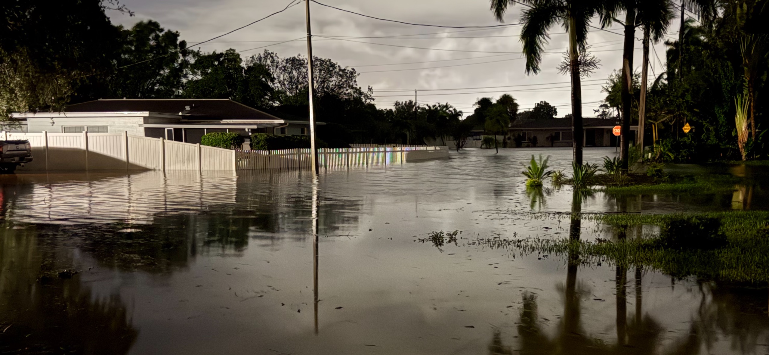
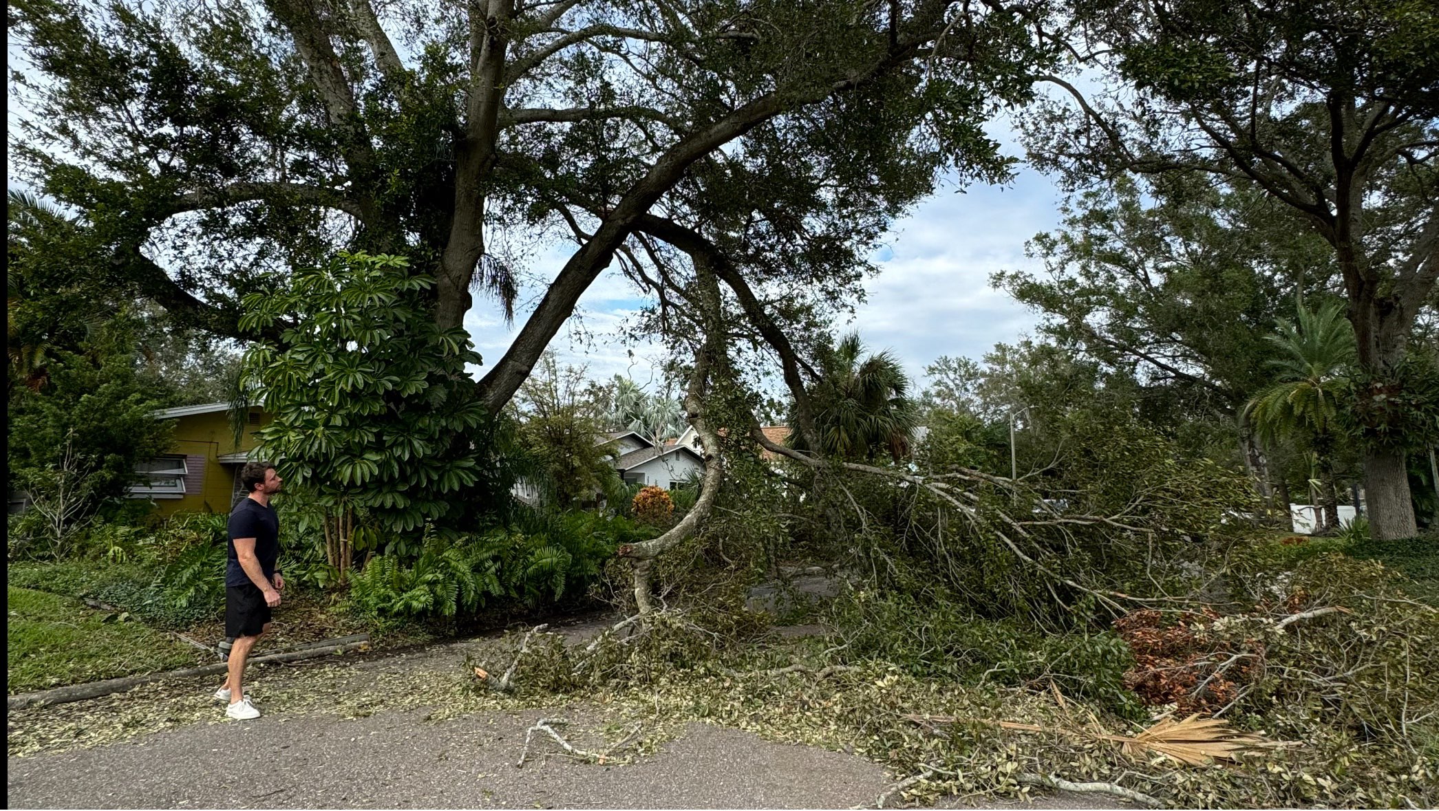
Hurricane Helene produced historic surge flooding not experienced in the Tampa Bay region for nearly 100 years. My neighborhood had never flooded prior, according to FEMA records and may not again for another 100 years. Hurricane Helene was a strong Category 2, strengthing into a strong Category 4 while it side swiped the Tampa Bay Area (Tampa & Saint Petersburg).
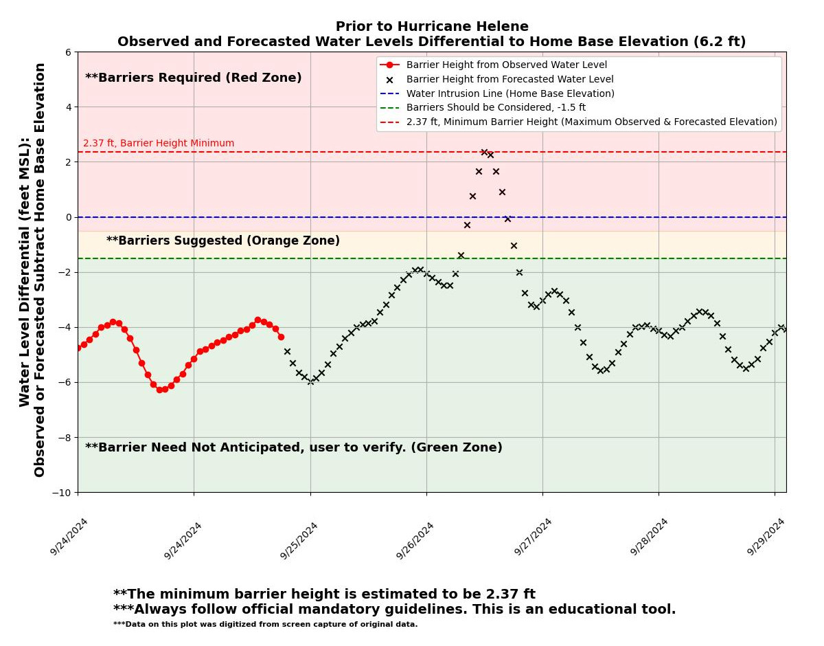
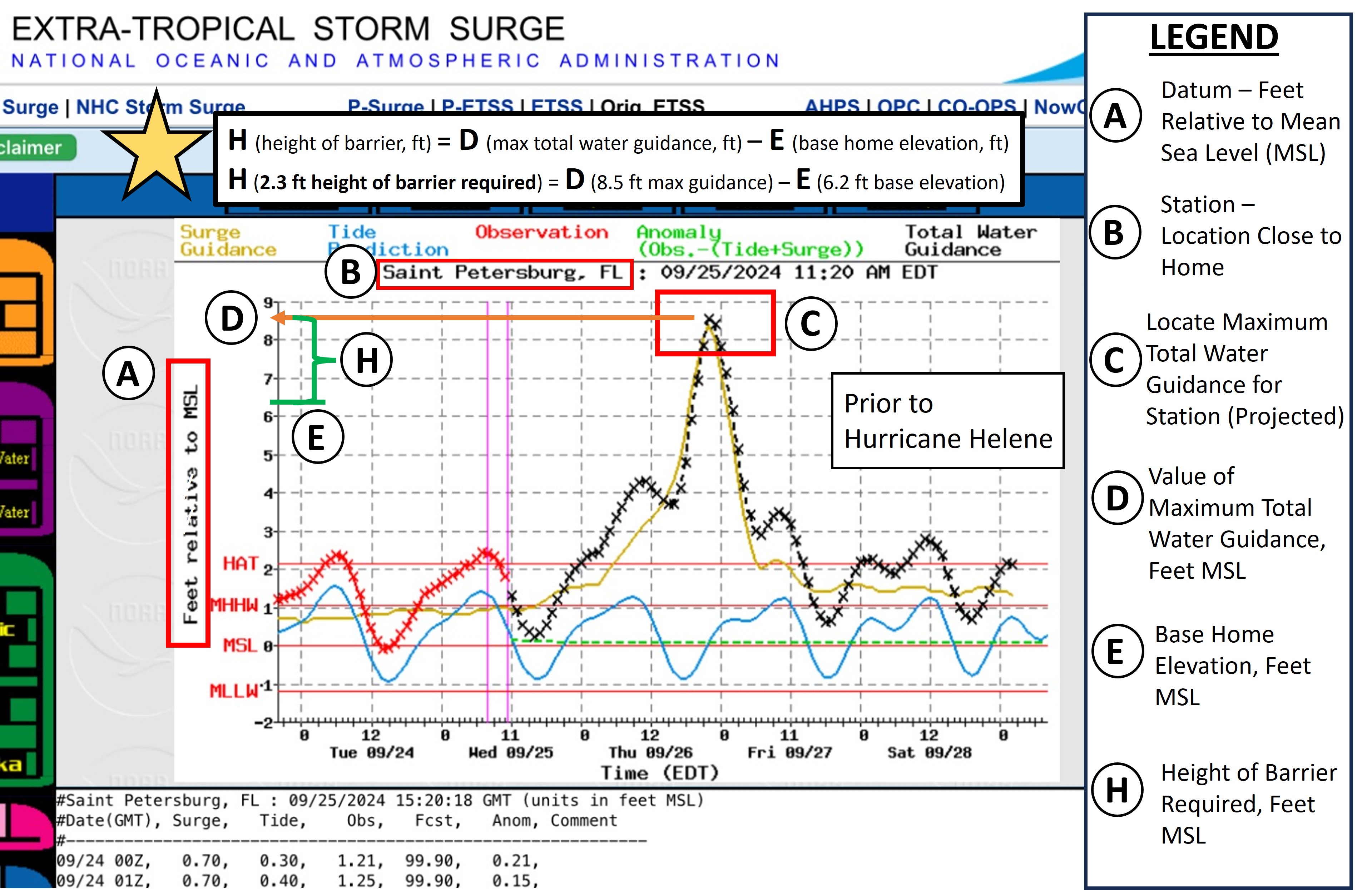
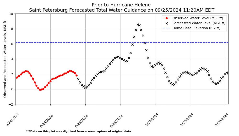
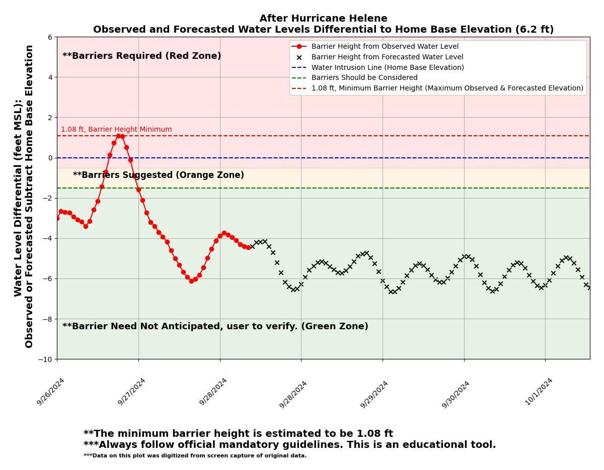
The NOAA Extratropical Total Water Guidance issued on 9/25/2024 at 11:20 AM, which was ~37 hours prior to the storm maximum water elevation (9/27/2024 at ~1:00 AM) of approximately ~8.5 feet Mean Sea Level (MSL). This would indicate my home at a base elevation of 6.2 feet MSL would experience ~2.3 feet of surge flooding. The ~2.3 feet is the minimum forecasted size of barrier that I would need to protect my home.
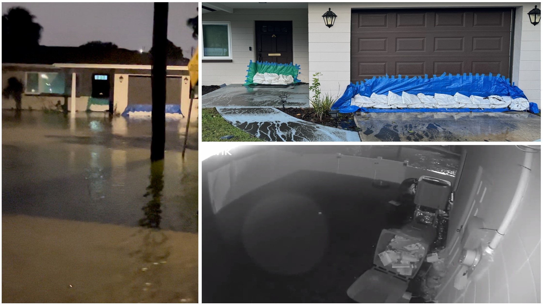
I began constructing barriers, making improvements to each barrier as each one was completed. Each barrier ranged from 2-4 feet in height depending on the limited materials I had available. The barrier construction section will note on some of the things I learned. I also had to take into consideration that I needed to evacuate from the flood zone for my own safety.
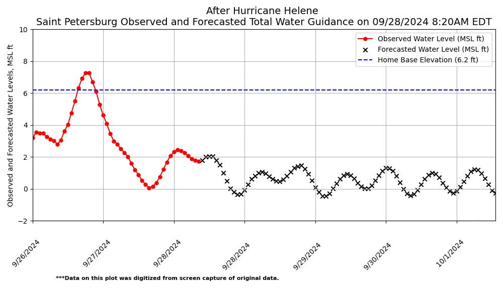
The NOAA Extratropical Total Water Guidance issued on 9/28/2024 at 8:20 AM, noted the the Total Water Guidance Observed on 9/27/2024 at ~1:00 AM was approximately ~7.2 feet MSL. The observed water level (~7.2 feet) would indicate my home base elevation experienced 1.0 feet of water. But wait, there's more!
I measured a ~17 inch water line from my home's base elevation. This would mean that the Measured Water Level at my home was approximately ~7.6 feet (= 6.2 feet + 17 inches).
- The NOAA Extratropical Total Water Guidance issued on 9/25/2024 at 11:20 AM (37 hours prior) was ~8.5 feet, and the result was ~7.6 feet measured by the water line on my home.
- There was a difference of 1.3 feet (8.5 ft - 7.2 ft) between the NOAA Forecast Water Level (37 hours prior) and the Observed Water Level at the NOAA station.
- There was a difference of 0.9 feet (8.5 ft - 7.6 ft) between the NOAA Forecast Water Level (37 hours prior) and the Observed Water Level at my house.
Summary of Hurricane Helene Data Results
Home Base Elevation
(6.2 feet MSL) |
Water Level
(feet, MSL) |
Minimum Barrier Height
(feet) |
Difference from Forecasted on 9/25/2024
(feet) |
Difference from Measured at Home
(feet) |
| Forecasted (9/25/2024 11:20 AM) |
8.5 |
2.3 |
- |
0.9 |
| Maximum Observed During Helene (9/27/2024 at ~1AM) |
7.2 |
1.0 |
-1.3 |
0.4 |
| Measured Water Line at Home |
7.6 |
1.4 |
-0.9 |
- |
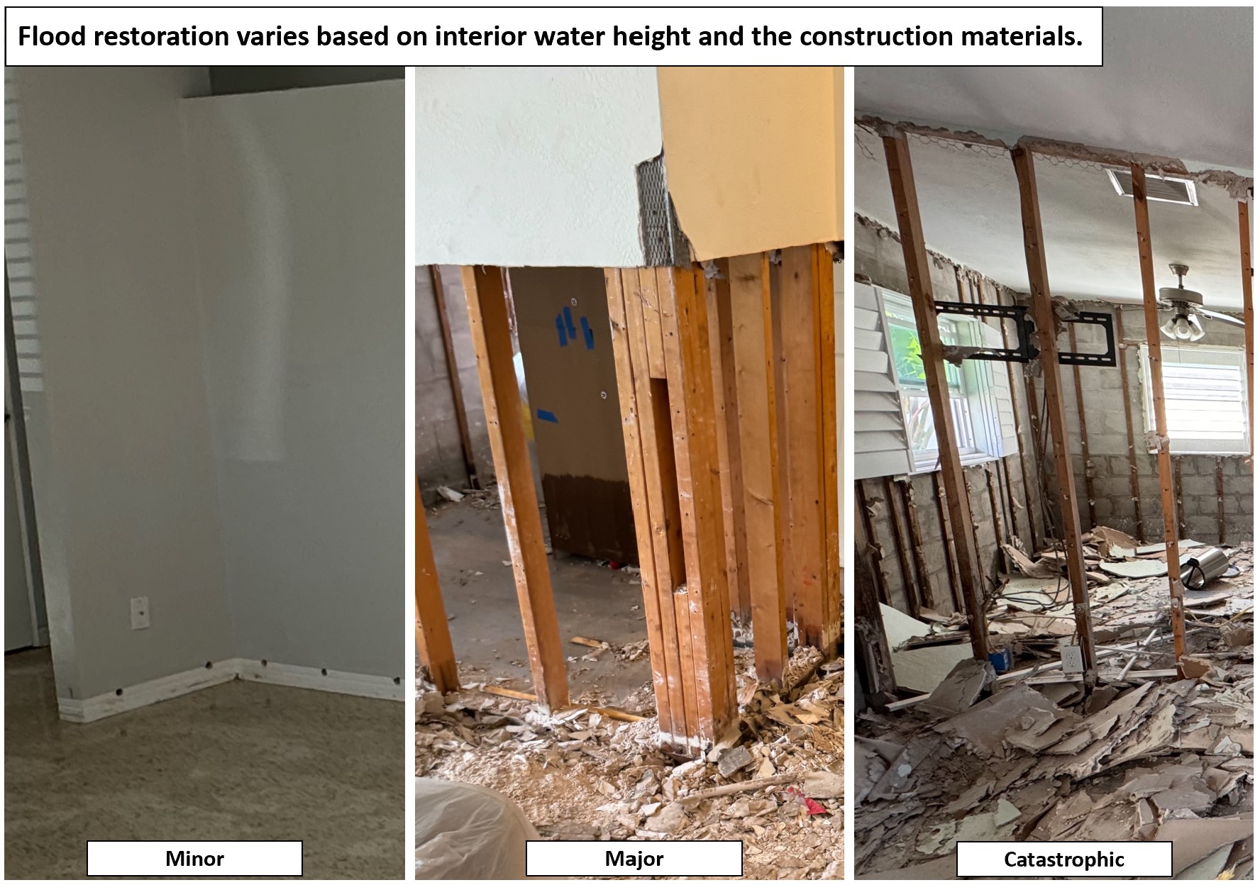
-This is absolutely IMPRESSIVE!! I was able to use publicly available data to determine 37 hours in advance that I needed barriers at least 2.3 feet tall, which was within 0.9 feet of the measurement at home. The barriers significantly reduced the interior water as mentioned in the page's introduction, as well as the damages to my home.
×
1 / 4

2 / 4
3 / 4
4 / 4
❮
❯
Helene and Milton presented similar but different hazards. Hurricane Helene brought heavy rains, wind, and significant storm surge. Hurricane Milton brought significant winds, rainfall, and reverse storm surge where water receeded out of the Tampa Bay.
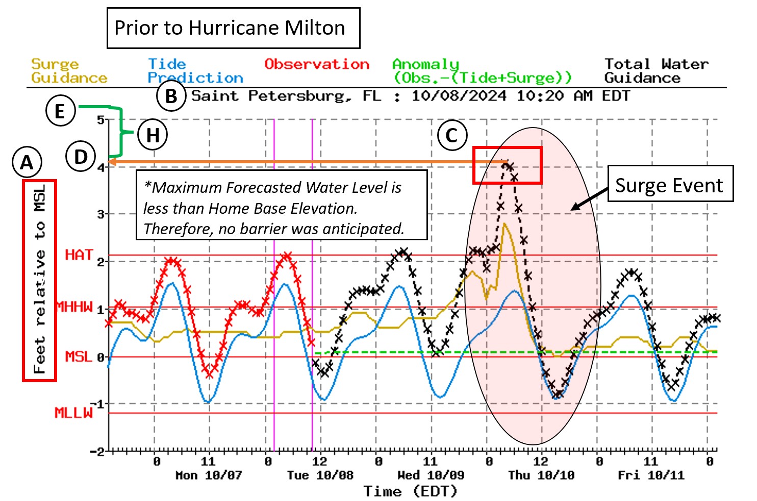
The NOAA Extratropical Total Water Guidance issued on 10/8/2024 at 10:20 AM, which was ~42 hours prior to the storm noted a maximum water elevation of approximately ~4.1 feet Mean Sea Level (MSL). The NOAA Extratropical guidance also noted there was a potential for reserve storm surge and water may recede from the Tampa Bay. The forecast indicated my home at a base elevation of 6.2 feet MSL would not experience surge flooding.
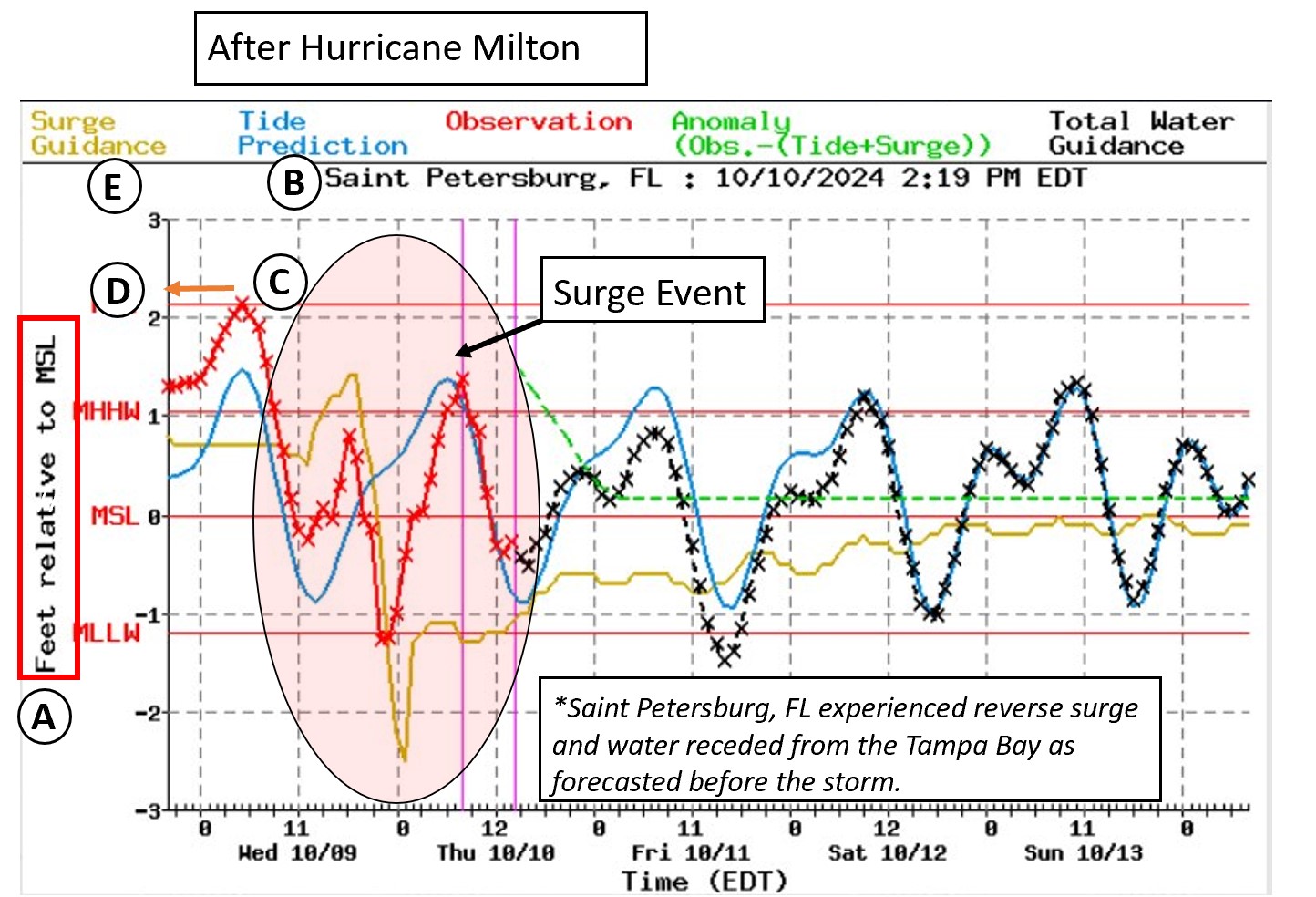
The NOAA Extratropical Total Water Guidance issued on 10/10/2024 at 2:19 PM noted the observed surge event maximum was ~2.14 feet on 10/09/2024 at 9:00 AM. The minimum was approximately -1.28 feet MSL on 10/10/2024 at 2:00 AM, indicating that reserve storm surge had occurred.
The forecast 42 hours prior to the maximum water elevation noted low lying areas may experience minor flooding. The track of Hurricane Milton also did slightly shift, as Milton proceeded to make landfall at Siesta Key, thus reducing the water level impacts experience in the Tampa Bay. NOAA, NHC, and local weather services provided excellent guidance throughout this storm!
×
1 / 4
2 / 4
3 / 4
4 / 4
❮
❯
Defend Your Home
Home Base Elevation Identification
FEMA Elevation Certificates are the easiest way to find your home's base elevation. FEMA provides guidance on their fact sheet which notes, "Elevation Certificates (ECs) are an optional tool used by the NFIP to evaluate a building’s First Floor Height (FFH) and adjacent elevation, stay in compliance with floodplain regulations and help lower the cost of flood insurance coverage."
FEMA Elevation Certificates are required in certain areas (i.e. Flood Zone A), which is found on FEMA's Elevation Certificate glossary.
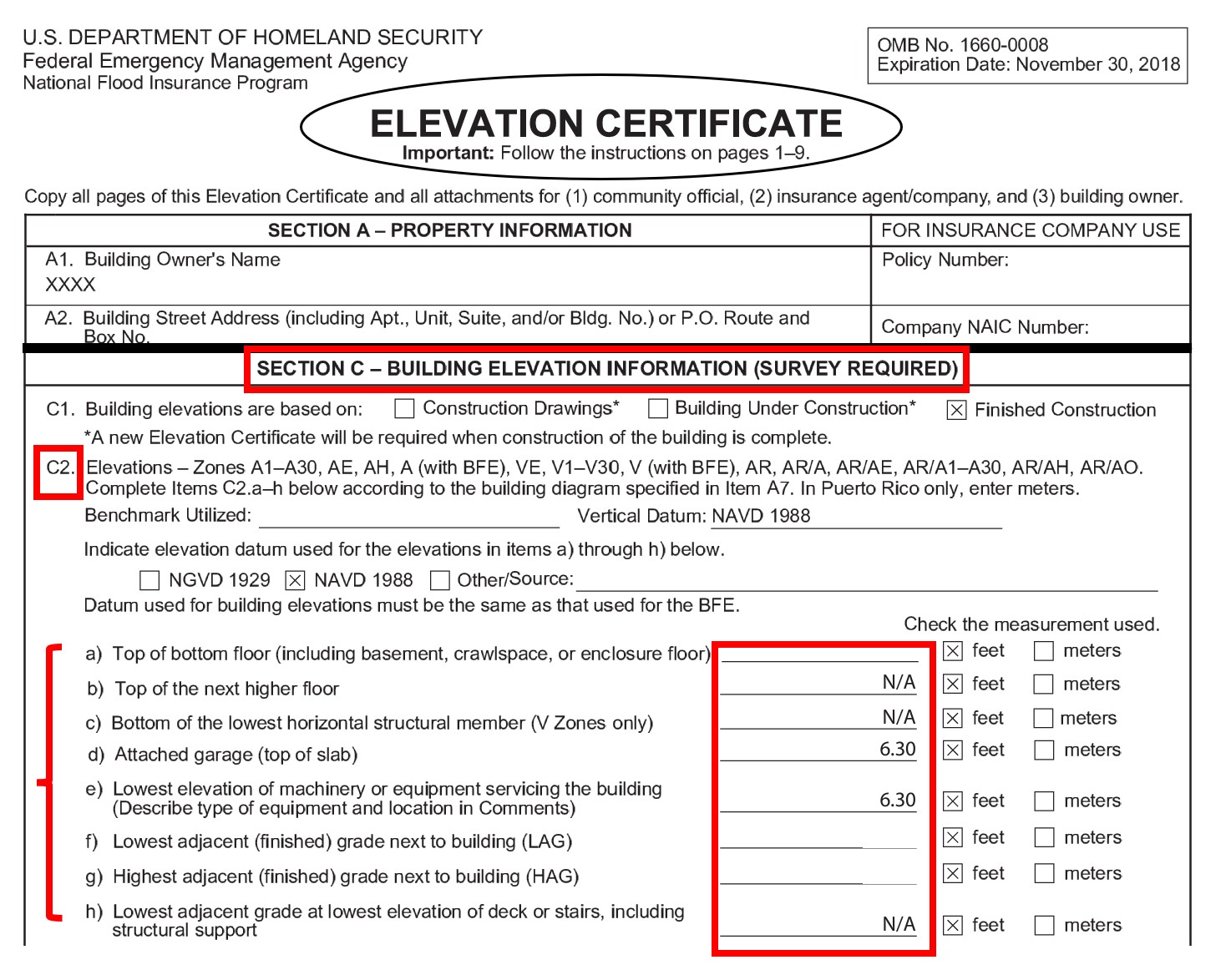
FEMA Elevation Certificate, Section C - Building Elevation Information (survey required) includes important elevations such as:
- Lowest elevation of machinery or equipment
- Attached garage (top of slab)
- Lowest adjacent (finished) grade next to building (LAG)
- Top of bottom floor
- Other elevations
The home base elevation in the python tool should reference the elevation at which the things you care about are located (lowest equipment, garage, bottom floor, etc.). Ensure elevation datums are the same for all data being used for comparisons. I use the FEMA Elevation Certificate, Section C, C2, Part d) Attached Garage (top of slab) elevation as my home base elevation.
Other methods to identify your home base elevation are:
- Google Earth or similar GIS Programs- estimate from your lawn around the house. Ensure vegetation (i.e. trees, bushes, and plants) are not causing elevations to be artificially inflated.
- U.S. Geological Survey (USGS) National Map - the search bar can be used inside the viewer to explore various layers that may include elevations.
- Hire a land surveyor to measure these elevations.
- City or County Property Appraiser - there may be links to elevation certificates in a property's details. Each State and County will vary.
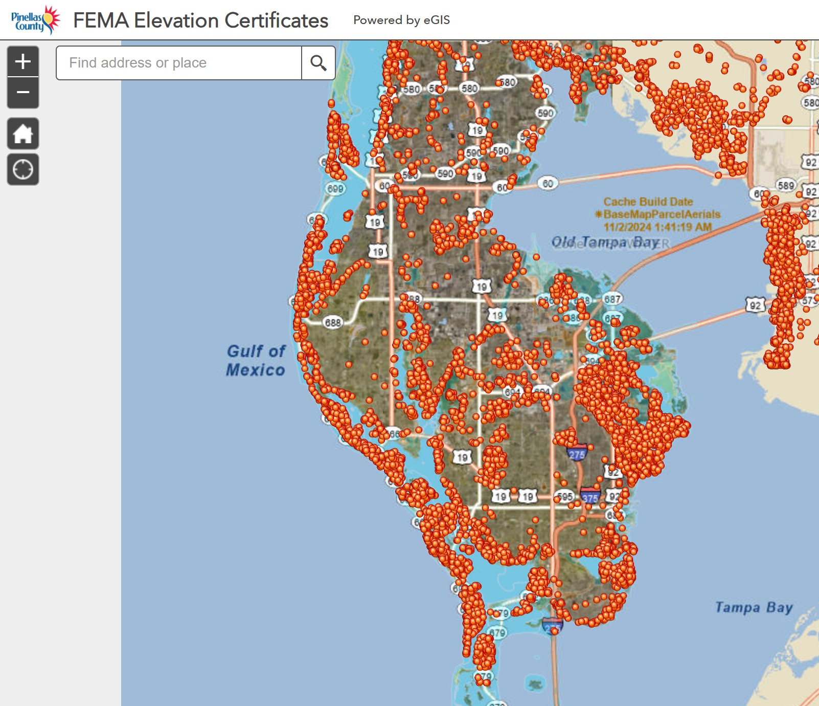
- Pinellas County, Florida FEMA Elevation Certificate website - Pinellas County, Florida's website contains a searchable GIS map to locate elevation certificates.
×
1 / 4
2 / 4
3 / 4
4 / 4
❮
❯
How to Build Barriers
Sand bags are meant to help protect your home from minor flooding. Major storm surge will require additional layers (no guarantees) and the difficulty to defend your home increases as the water depth increases. Tampa Bay 10 News' The dos and don'ts of using sandbags during hurricane season. Here are the highlights:
- Sand bags help protect against minor flooding. Storm surge is very difficult.
- Local sand bag sites are typically listed on City and County's websites.
- Sand bag sites may limit how many bags you can get each time. You typically can take multiple trips. Bring proof of residency and a shovel.
- Fill sand bags half way up so when they get water in them, they can expand.
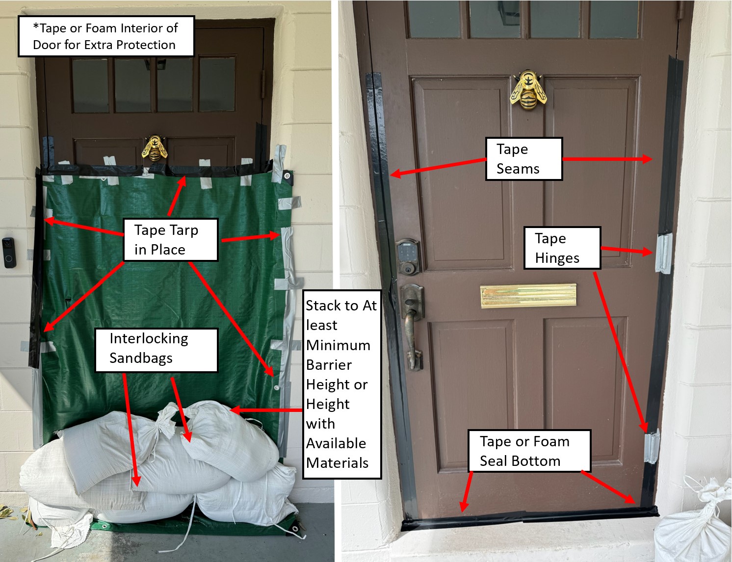
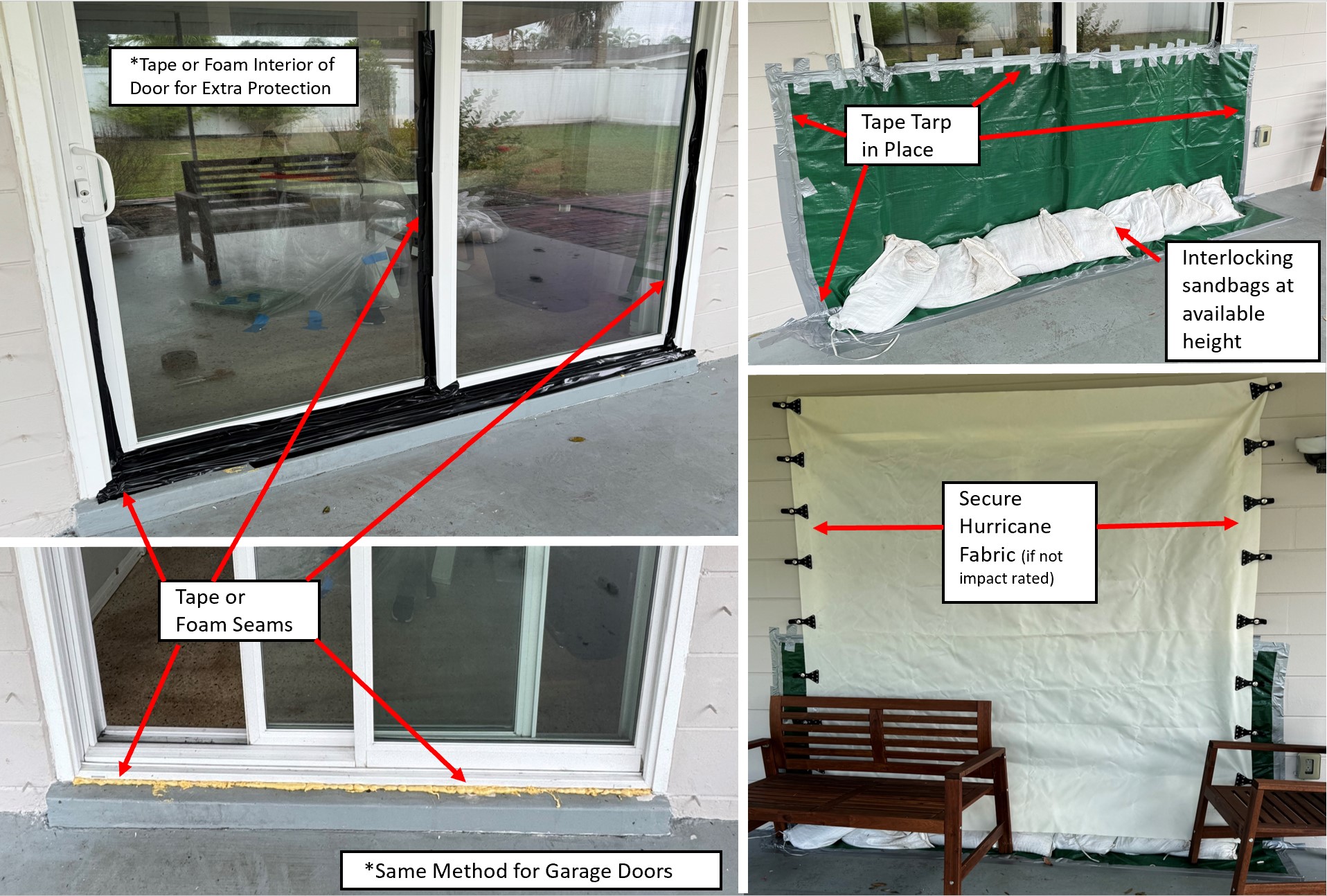
- A tarp should be placed on the outside of the door and taped into place. Sand bags should be then placed on top of the tied end (tail) of the previous sand bag. Continue to do this across the entire entry.
- The next layer should be offset on top of the first layer and continue to place the top of the tied end of the previous bag.
- Add additional layers.
How to Upgrade Your Flood Barriers:
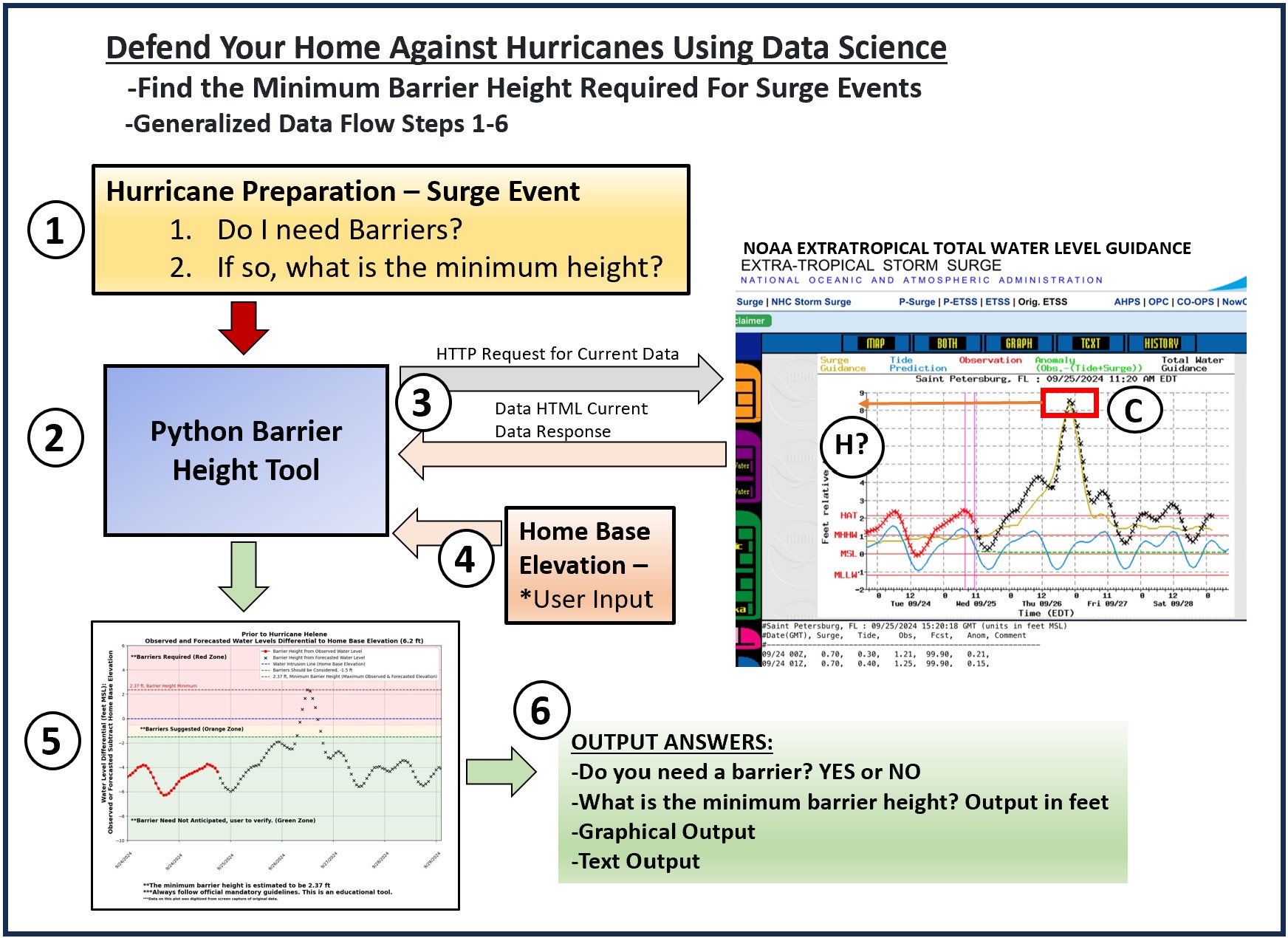
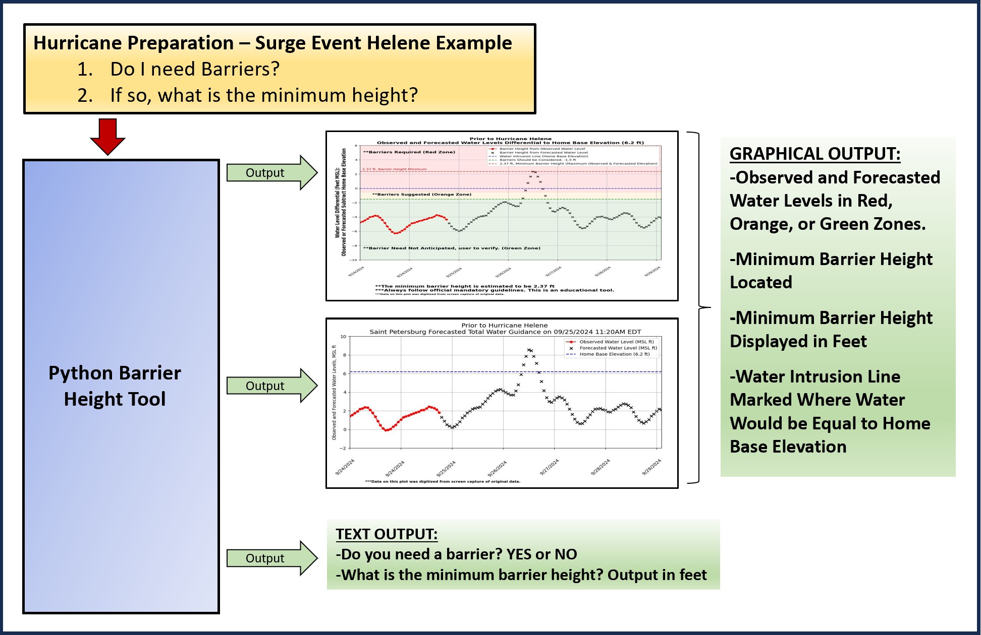
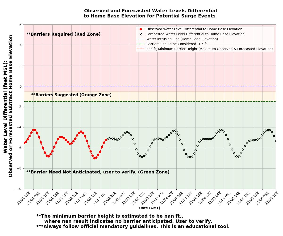
- Determine Minimum Barrier Height - Utilize the python tool to determine the maximum forecasted and observed water elevation in comparison to your home.
- Tape, Foam Spray, Caulk to Seal Openings - Use tape or foam spray in order to seal all cracks for doors, door frames, garage doors, vents, and other openings to your house. Every entry makes your home vulnerable to water intrusion.
- Tape Plastic Over Small Openings - Consider using plastic and tape into place to fill gaps and other areas water may enter.
- Products with Reported Success - Duct tape, painters tape, gorilla tape, Flex Seal tape, Flex Seal spray, and other similar products. I have used duct tape, painters tape, gorilla tape, foam spray, and caulk depending on the water height anticipated.
- Tape the Seams of Everything! - Yes, anywhere water can enter or get past the barrier needs to be sealed.
Which Method Should I Use?
Storm surge estimates often include ranges from 1-15 feet, however this estimate is not a true representation of how height the water will be at your home based on its elevation. I used NOAA’s ETSS to estimate the minimum barrier height I needed before Hurricane Helene. It is ultimately up to each person how to protect their home and how they want to proceed. Here are some ideas for how I protect my home (subject to change):
-
The best method to sealing your home is a combination of sand bags, tarps, foam spray, caulk, flex seal, and other similar products. First examine the outside of your house and locate all openings such as exterior doors, vents, ducting, crawl spaces, etc. Develop a plan to seal each opening for example a door’s seams can be taped, a tarp placed on the exterior, interlocking sand bags, and tape the tarp in place. Each opening will require you to use your MacGyver skills.
- Ensure all low lying entries to your home are identified: dryer vents, AC plumbing lines, cracks in exterior, new additions may experience seepage, etc.
-
The level at which you should seal your home will depend on the maximum water level forecasted in comparison to your home base elevation.
- No flooding projected, however may want to place sand bags in case track changes.
- 0-2 feet: Sand bags + tarp + taping seams
- 2+ feet: Caulking door shut or foam/peal spray.
Please let me know if you have other ideas or success with specific products! Thanks!
Disclaimer and Safety Information